×
模态框(Modal)标题
在这里添加一些文本
Close
Close
Submit
Cancel
Confirm
×
模态框(Modal)标题
×
Journal
Article
Figure
Search
EN
中文
Home
About Journal
About Journal
Indexed in
Awards
Editorial Board
Guide for Authors
Browse
Current Issue
Online First
Archive
Highlights
Topic
Archive by Subject
Most Viewed
Most Download
Most Cited
E-mail Alert
RSS
Subscribe
Publication Ethics
Contact us
EN
中文
Figure/Table detail
Cognition of contemporary city maps and interpretation of their map representation: Case study of a German-made urban planning map of Qingdao in 1910
XU Min, WU Tingjin, ZHAO Lin
PROGRESS IN GEOGRAPHY
, 2024, 43(
6
): 1219-1232. DOI:
10.18306/dlkxjz.2024.06.013
Fig.1
Urban planning map of Qingdao in 1910 shown in
Chinese History of Urban Construction
(the first edition)
Other figure/table from this article
Fig.2
Temporal distribution of large scale maps of Qingdao made between 1897 and 1914
Fig.3
Comparison between the map of current Qingdao made by German in 1910 (a), the "1910 Map" (b), and the urban planning map of Qingdao made by Japanese in 1915 (c)
Fig.4
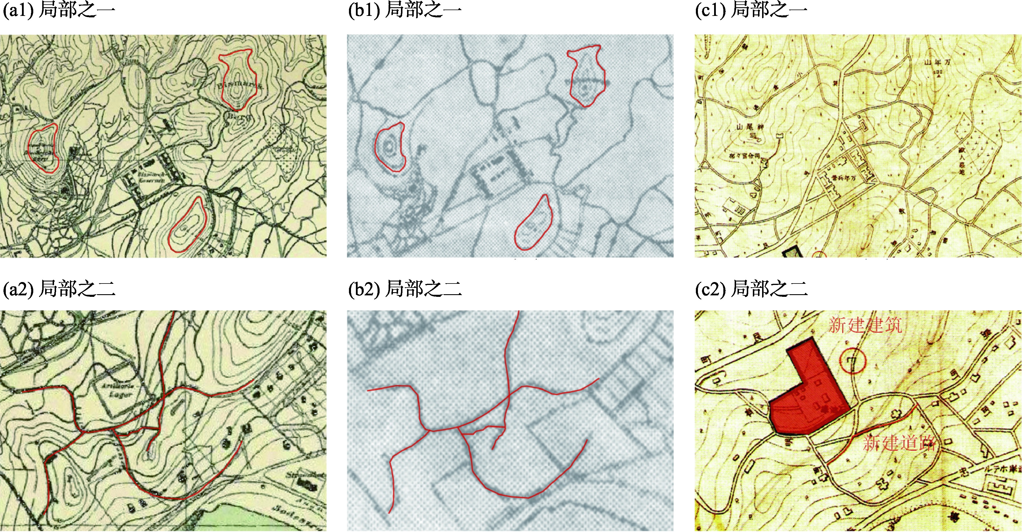
Comparison of map details between the map of current Qingdao made by German in 1910 (a1, a2), the "1910 Map" (b1, b2), and the urban planning map of Qingdao made by Japanese in 1915 (c1, c2)
Fig.5
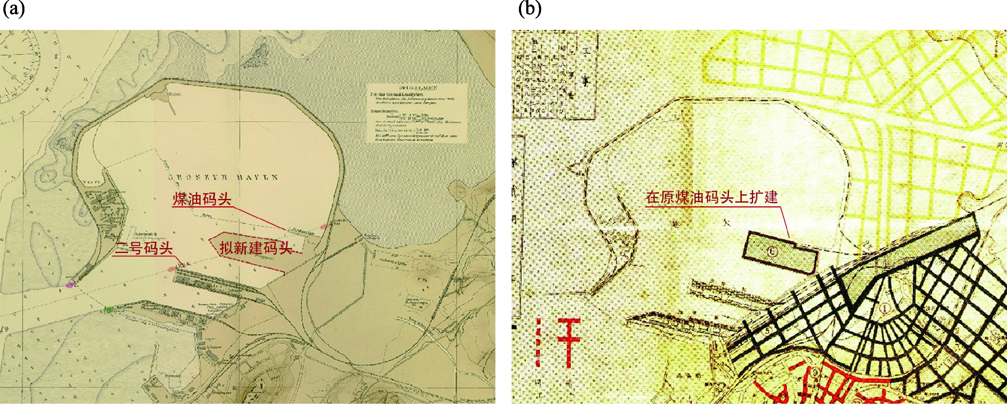
Comparison of the planning schemes of Dagang Harbor in the map of 1908 (a) and the map of 1915 (b)
Fig.6
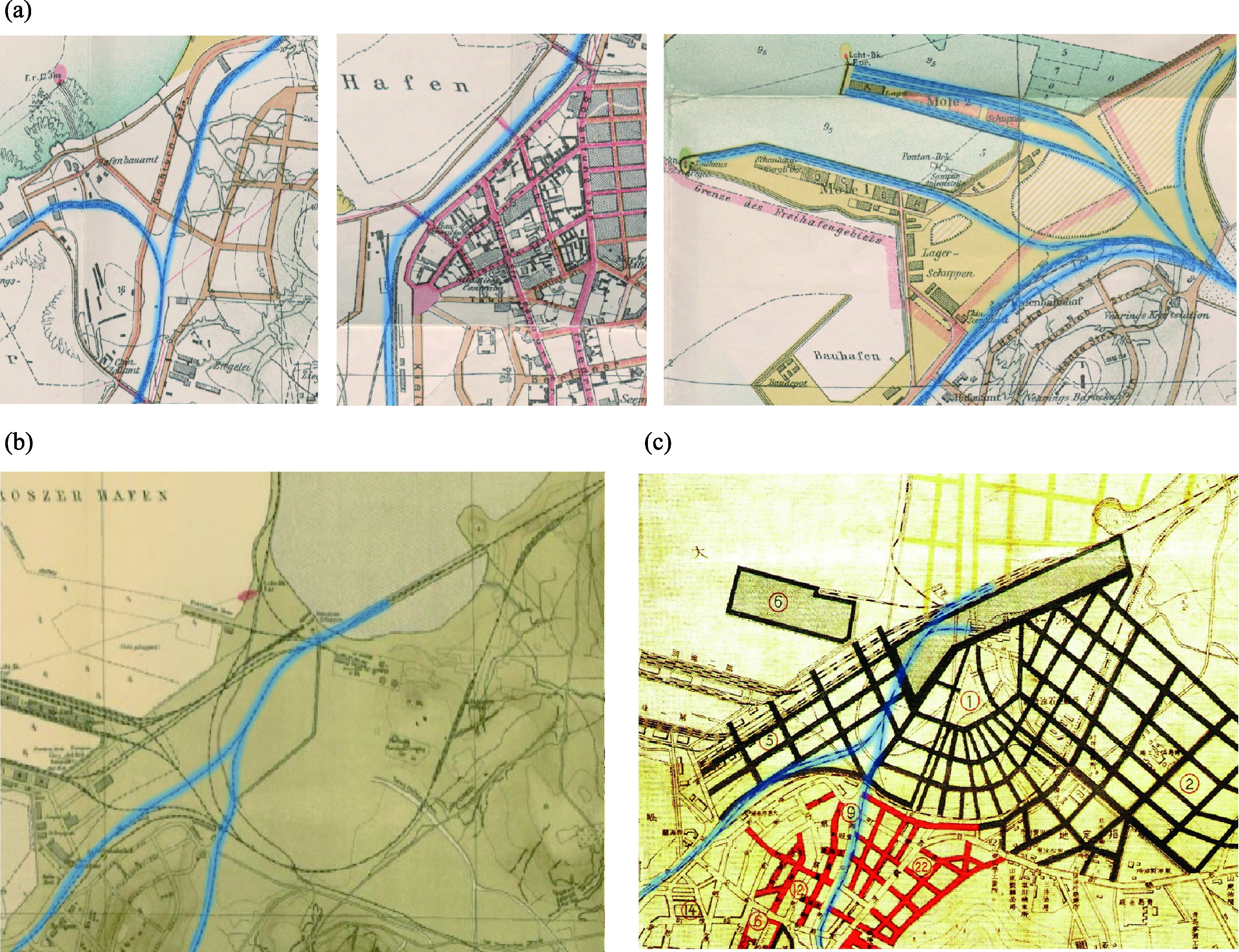
Comparison of the harbor between the maps of 1905-1915 and the "1910 Map"
Fig.7
The U-shaped structure of Dagang Harbor in the historical aerial views
Fig.8
Comparison of railways made by the Germans and the road network planned by the Japanese in 1915
Fig.9
Comparison between the map of 1958 made by the Architectural Society and the "1910 Map"
Fig.10
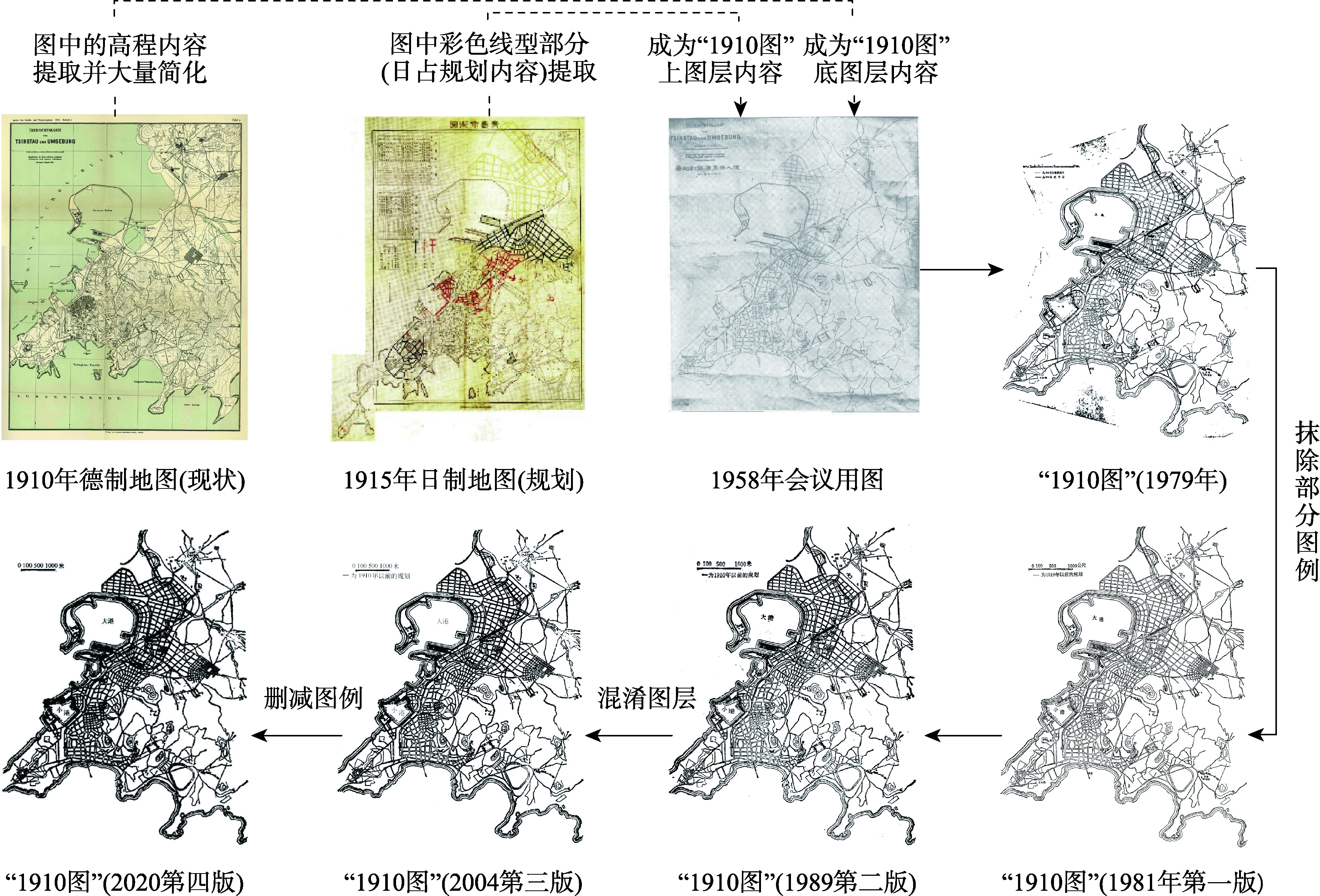
Origin and dissemination process of the "1910 Map"