×
模态框(Modal)标题
在这里添加一些文本
Close
Close
Submit
Cancel
Confirm
×
模态框(Modal)标题
×
Journal
Article
Figure
Search
EN
中文
Home
About Journal
About Journal
Indexed in
Awards
Editorial Board
Guide for Authors
Browse
Current Issue
Online First
Archive
Highlights
Topic
Archive by Subject
Most Viewed
Most Download
Most Cited
E-mail Alert
RSS
Subscribe
Publication Ethics
Contact us
EN
中文
Figure/Table detail
Construction of rural and urban spatial system and path of revitalization from the perspective of rural area grouping
XU Xiaochun, LAN Jing
PROGRESS IN GEOGRAPHY
, 2025, 44(
1
): 117-130. DOI:
10.18306/dlkxjz.2025.01.009
数据名称
时间
数据来源
行政边界数据
2020年
国家地理信息公共服务平台(
https://www.ngcc.cn
)以及当地政府部门
珞珈一号(LJ1-01)夜间灯光数据
2020年
高分辨率对地观测系统湖北数据与应用中心(
http://www.hbeos.org.cn
)
POI数据
2020年
高德开放平台(
https://lbs.amap.com
)
道路数据
2020年
OpenStreetMap数据库(
https://planet.openstreetmap.org
)
土地利用数据
2020年
地理监测云平台Landsat TM 影像(
http://www.dsac.cn
)
社会经济数据
2020年
静海区人民政府(
http://www.tjjh.gov.cn
)以及当地政府部门
Tab.2
Data sources
Other figure/table from this article
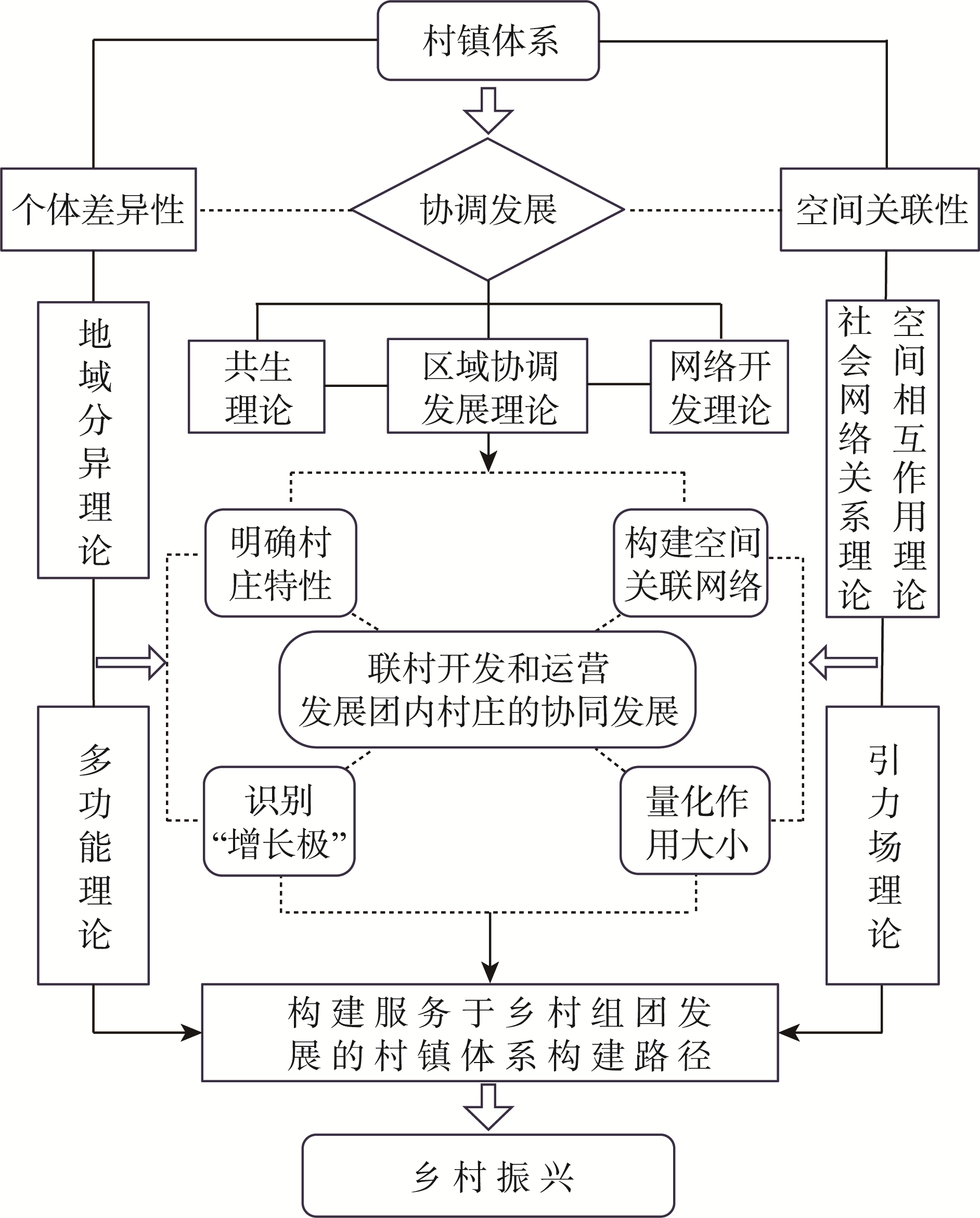
Fig.1
Theoretical analysis framework
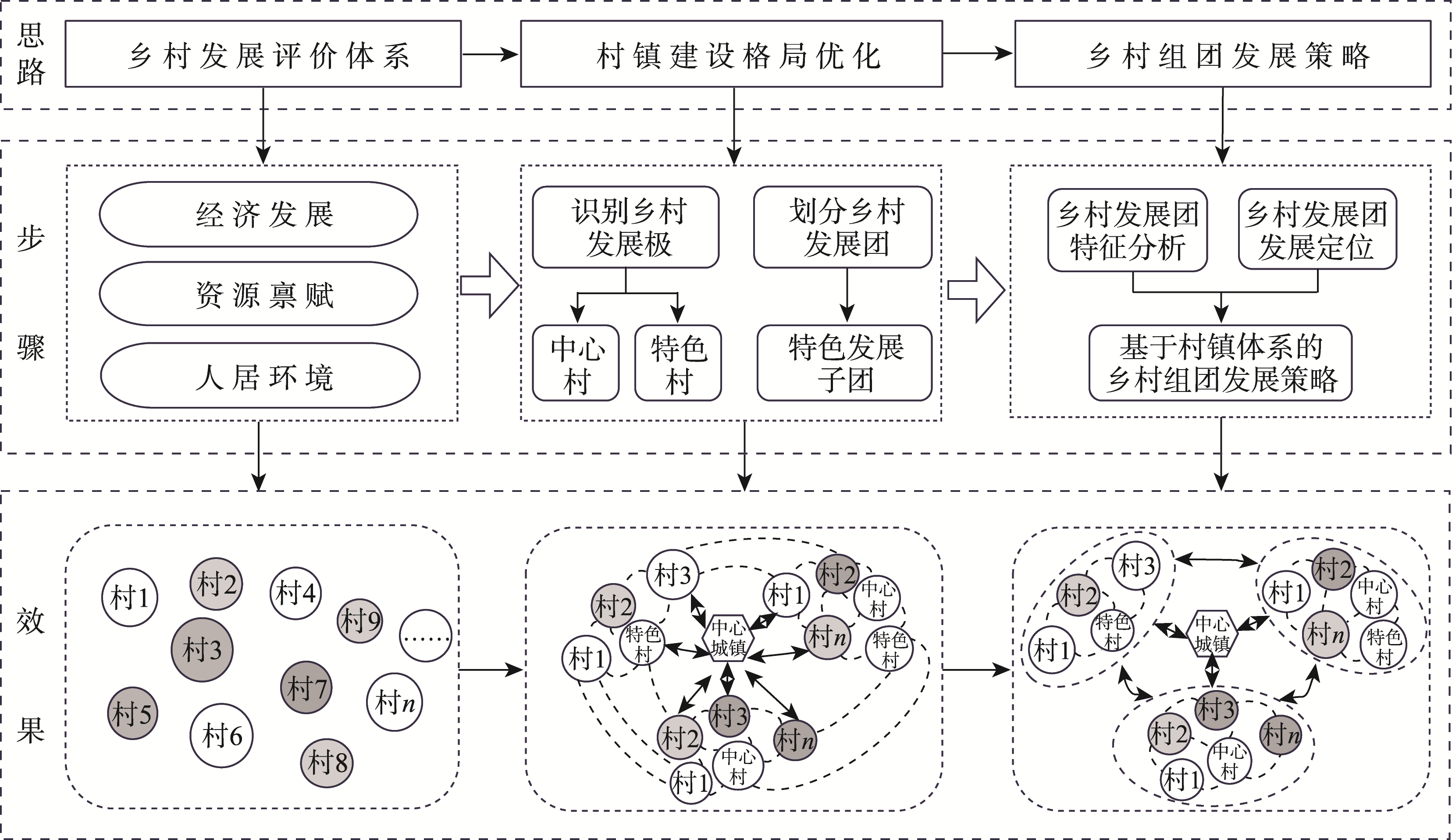
Fig.2
Roadmap of the research
Tab.1
Indicator system for evaluating the level of rural development
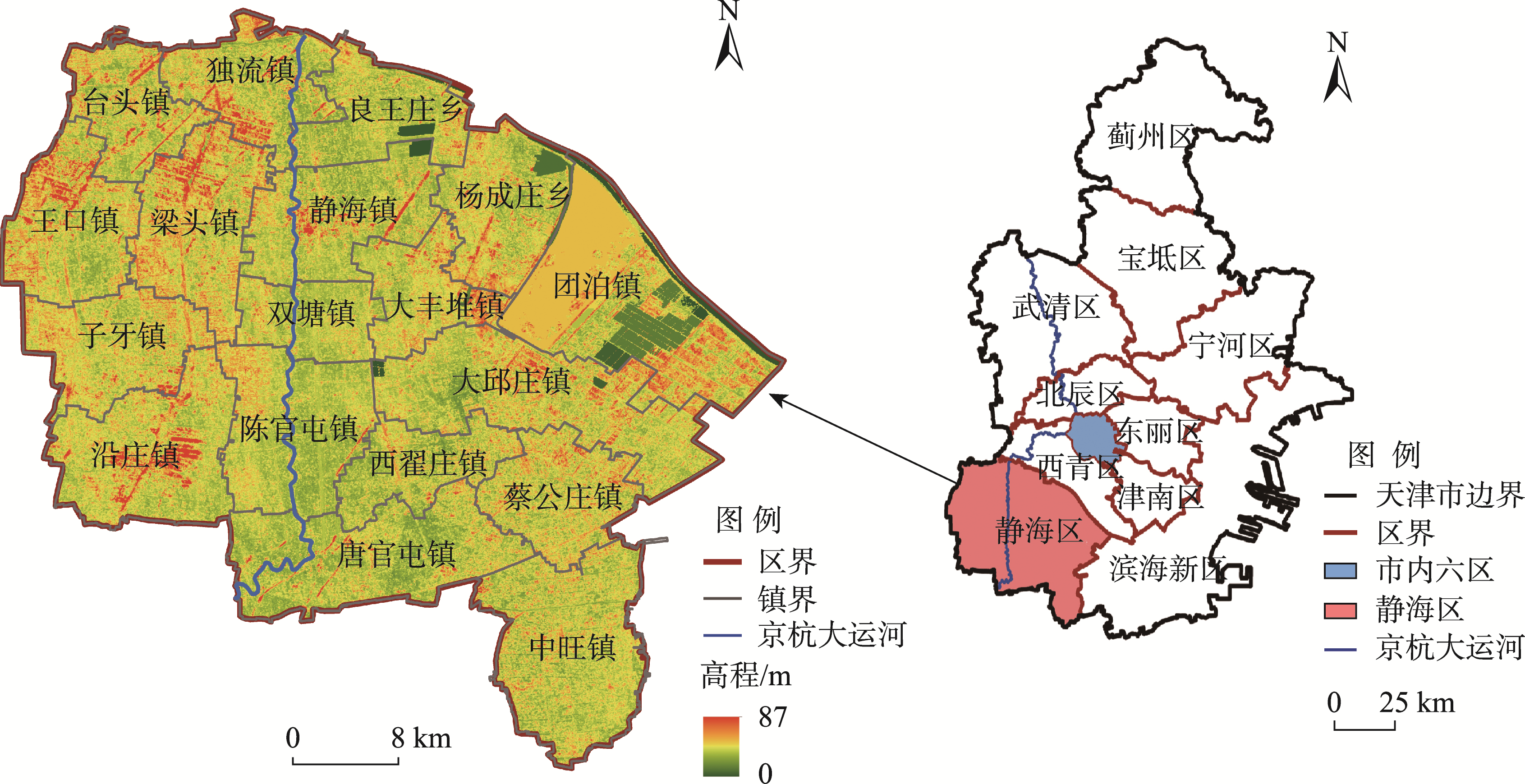
Fig.3
The study area
Fig.4
Construction of village symbiosis network and identification of central villages
Tab.3
Hierarchy of village development in the study area
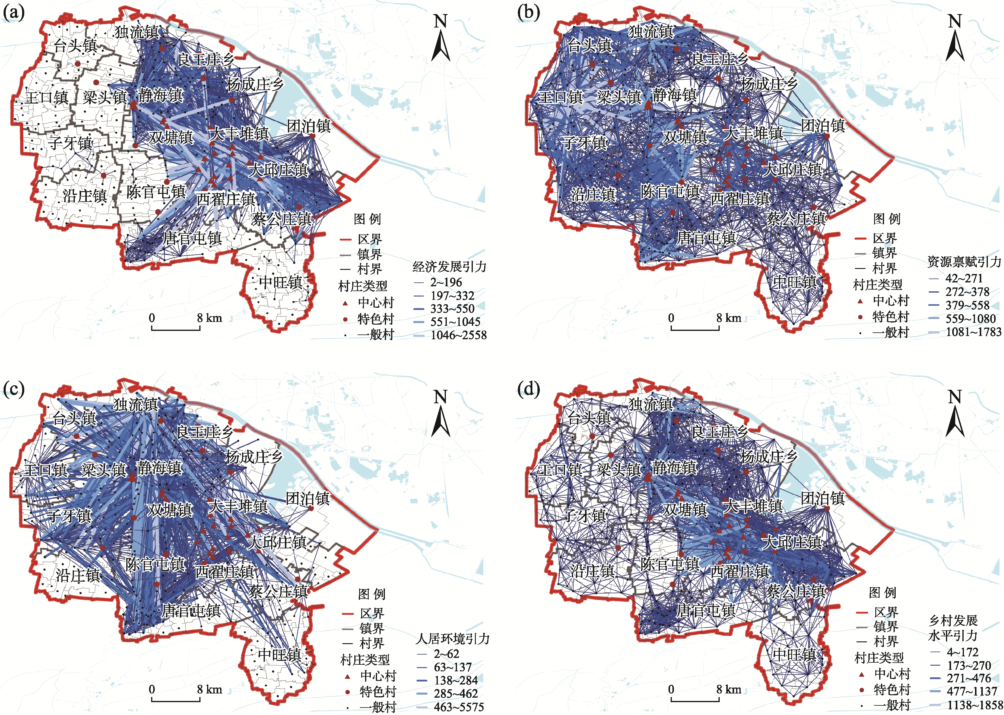
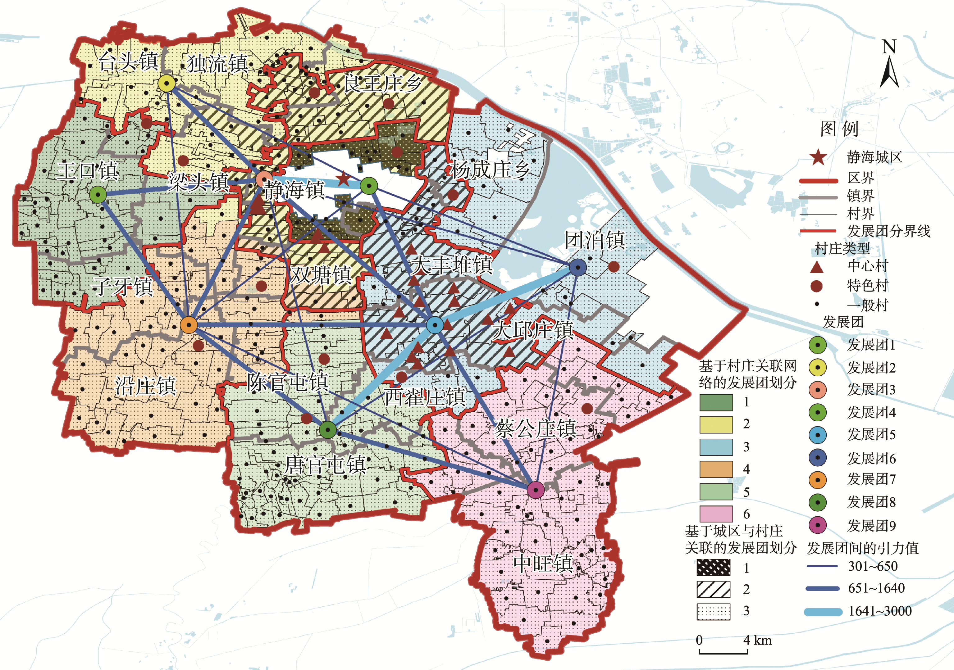
Fig.5
Segmentation of rural development clusters based on social network analysis
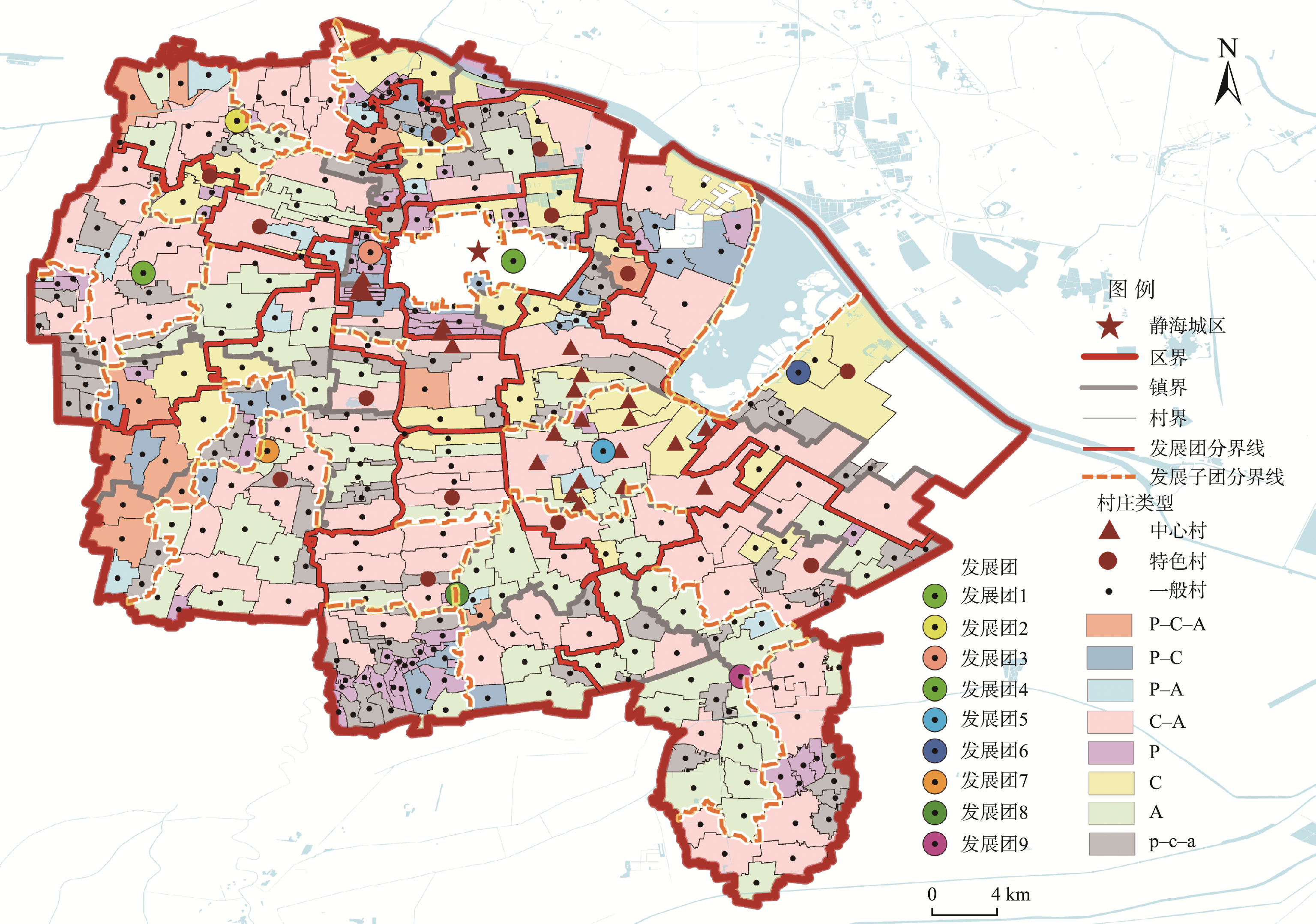
Fig.6
Optimization of the pattern of rural and urban spatial system
Tab.4
The number and type of villages of the village development clusters
Tab.5
Structure and development path of the village development clusters