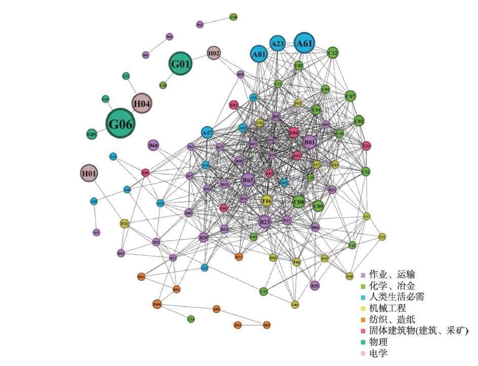
"Development driven by innovation" is an important strategy of the Chinese government. This study used data including inter-city patent transfer from China Intellectual Property Office for 2017 and 2018 to explore the technology-introduction pattern of cities in China from the perspective of technology relatedness and complexity, using Gephi, ArcGIS, and Stata. This study hypothesized that: 1) cities tend to introduce technologies highly related to local knowledge structure; 2) the more complex a technology is, the less opportunity that cities will introduce it; and 3) the relatedness of a technology will mitigate the effect of its complexity on technology transfer. Based on the average relatedness and average complexity of technologies introduced in each city, this study identified four technology-introduction patterns, which are "high relatedness and high complexity", "low relatedness and high complexity", "low relatedness and low complexity", and "high relatedness and low complexity". Furthermore, unique mechanisms of change exist for different technology-introduction patterns. This study found that the complexity of introduced technologies increases with the economic development stage of the city, while the relatedness of that displays an inverse U-shaped mode. Hence, we divided technology introduction into three stages according to the level of urban development: 1) the learning stage dominated by low relatedness, 2) the reinforcing stage dominated by the increase in relatedness, and 3) the leaping stage dominated by diversification into unfamiliar technology fields. The empirical results show that in general, the increase in technological relatedness and the decrease in complexity of a technology will promote cities to introduce the technology, and the increase in relatedness will encourage cities to introduce more complex technology in that field. Additionally, the mechanism of change was tested through regression by groups—cities were sorted into four groups by their GDP per capita and population density, then we performed regression on technological relatedness and complexity respectively, which shows that the coefficient of relatedness lost significance in the most developed 25% cities, while it remained robust in the other three groups. The coefficient of complexity similarly lost significance in the most developed 50% cities. These results jointly verify the hypothesis of three technology-introduction stages. This study analyzed the pattern of technology-introduction empirically, stressing on the importance of relatedness and complexity in innovation research, which offers a grounded reference for guiding the innovation development path of cities.
Telecommunication equipment manufacturing is a pillar industry of the Chinese economy. Its spatial distribution has been evolving in recent years due to the rapid development of the industry. This study analyzed the spatial pattern and underlying factors of new telecommunication equipment ventures with detailed firm-level data from the National Enterprise Credit Information Publicity System and China's Annual Survey of Industrial Firms, as well as analytical methods including kernel density analysis and negative binomial regression. The analysis points to the following key findings: 1) China's new telecommunication equipment manufacturing ventures tend to cluster in four leading city-regions—the Pearl River Delta, Yangtze River Delta, Beijing-Tianjin-Hebei Area, and Chengdu-Chongqing Area. 2) Within these four city-regions, firms in this industry have been diffusing from central cities to the peripheries. 3) A few clusters of leading firms have been observed in inland regions previously with limited bases for this industry, such as Nanchang, Honghe, Zhengzhou, and Guiyang cities. 4) Knowledge complexity and the existing industrial base of cities are positively associated with the entry of all new firms. The density of related industries is positively associated with the entry of domestic enterprises and large-scale enterprises. Unrelated variety correlates with the entry probability of foreign-invested enterprises and large-scale enterprises. Furthermore, our analysis suggests that globalization and government intervention are associated with the entry of foreign-invested and large-scale enterprises, respectively.
Regional innovation depends on the flow and combination of different knowledge. Knowledge gatekeepers spread the acquired external knowledge to the region and play a key role in regional innovation. However, the role of knowledge gatekeepers in different regional contexts remains to be discussed. Based on the patent cooperation data from 2001 to 2015, this study used social network analysis to identify knowledge gatekeepers in the Yangtze River Delta and measure its contribution rate. It then analyzed the spatial variation characteristics of quantity and contribution rate. Furthermore, this study used regression models to explore the importance of gatekeepers in cities with different knowledge bases. The results show that: 1) The proportion of enterprises among gatekeepers in the Yangtze River Delta has increased, but the contribution of gatekeepers is still dominated by universities. The openness of colleges and universities enables them to perform their functions as knowledge gatekeepers better than enterprises. Cities with a large number of gatekeepers in the Yangtze River Delta are concentrated in the Shanghai-Nanjing-Hefei-Hangzhou-Ningbo development zone, and the contribution rate of knowledge gatekeepers presents a core-periphery structure. Gatekeepers can promote and restrict the acquisition of external knowledge. Hangzhou and Shanghai, where gatekeeper contribution rate was high at the early stages, increased direct external contacts to improve the efficiency of knowledge absorption and dissemination. Other cities with low gatekeeper contribution rates continue to rely on the role of gatekeepers. 2) External linkages of cities have a significant positive impact on the renewal of urban knowledge and the mechanism of knowledge gatekeepers on urban knowledge renewal is spatially heterogeneous. Cities with specialized knowledge bases rely more on external connections through gatekeepers. They need gatekeepers to access, absorb, and use external knowledge. In order to reduce the noise in knowledge flow, cities with diversified knowledge base tend to obtain external knowledge by direct connection. The results of this study provide a policy support for regional collaborative innovation by indicating that regional knowledge renewal should be suitable for the cities of concern, and promote the regional endogenous growth model driven by knowledge spillover.
Construction land is a spatial carrier of urban economic and social activities, and its utilization efficiency is an important basis for regulating the expansion and allocation of construction land. This study took the shrinking city Yichun of Heilongjiang Province as an example, and used data envelopment analysis (DEA) model and Geodetector to analyze the spatiotemporal change and influencing mechanism of spatial differentiation of construction land use efficiency from 1995 to 2015. The research reveals the following points: 1) The overall level of construction land use efficiency in Yichun City is not high, and it generally shows a trend of "rising first and then descending" from 1995 to 2015. From the perspective of temporal change, the regional differences of construction land use efficiency in Yichun were gradually decreasing, and the overall efficiency level developed towards a low-level equilibrium. 2) From the perspective of regional differences and spatial characteristics, the regional differences of construction land use efficiency in Yichun were obvious. Construction land use efficiency showed a decreasing trend from the northern and southern ends to the central part, which generally forms a spatial pattern of "high in the peripheral area and low in the core area". 3) Construction land use efficiency change in Yichun is the result of the joint action of multiple factors. The differences in per capita GDP of secondary and tertiary industries, non-agricultural population density, rationalization of industrial structure, optimization of industrial structure, and non-agriculturalization rate are highly related to the spatial differentiation of construction land use efficiency. However, the influence degree and sensitivity of some factors are slightly different in different periods.
The research of tourism flow network structure based on big data mining is one of the main directions of advanced tourism flow research. Using web crawler technology, this study captured the tourism flow data of five major urban agglomerations in coastal China from Ctrip, then examined the spatial structure of tourism flow network, and analyzed the spatial network structure characteristics of tourism flow from the aspects of network density, node structure, network aggregation subgroups, core-periphery characteristics, and structural holes. The results show that: Firstly, the tourism flow network structure of the five major urban agglomerations in coastal China has hierarchical and rank-size characteristics. Secondly, the cohesive subgroups are closely related to each other, but there is little interaction among them. Thirdly, the core areas are all located in the Yangtze River Delta urban agglomeration, and the "trickling down effect" of the core nodes on the peripheral nodes is limited. Lastly, Beijing, Xiamen, Qingdao, Guangzhou, Zhongshan, and Hangzhou have obvious advantages in the tourism flow network. Revealing the characteristics of spatial network structure of tourism flow using big data is of great significance for further understanding the connotation of flow space and optimizing the spatial layout of urban tourism.
Using aspatial equality measurement index to evaluate public transport services may overlook the spatial agglomeration relationship of the demand and supply of public transport services. Therefore, a public transport service evaluation framework based on spatial equality theory was proposed—at the global scale, an evaluation method that integrates the Gini coefficient and Moran's I indicator was developed, and at the local scale, a spatial gap analysis was employed to explore the coupling relationship between demand and supply at each analysis unit. The case study of Shenzhen City revealed that: 1) The egalitarian-based spatial equality index shows that the administrative districts with the best and worst spatial equality status are both located in the downtown area of the city, which are Luohu and Nanshan districts. 2) The local scale evaluation visually displays the demand and supply gaps and matching status at each analysis unit. The results indicated that there exist limitations in the use of the Gini coefficient alone when conducting public transport service evaluation—the same or similar Gini coefficients can correspond to completely different service supply and demand matching status.
Buses play an important role in the daily travel of urban residents. Bus micro-environmental pollution and its adverse impacts on passengers' physical and psychological well-being has become an increasing concern among the general public, researchers, and policymakers. However, few studies have examined the nonlinear effects of bus micro-environments on passengers' comfort, analyzed the threshold values of multiple micro-environmental variables, and ascertained the optimal micro-environmental exposure levels for passengers. In this study, real-time monitoring data of bus micro-environments, questionnaire survey data of 520 passengers, travel characteristics, and environments outside the buses were simultaneously collected on six bus routes in Guangzhou City. Nonlinear regression models constructed by random forest were then employed to explore the relationships between bus micro-environments and passengers' comfort. The results show that in-bus temperature, relative humidity, PM2.5 concentrations, noise, and passenger load have nonlinear effects on the comfort, but the importance and mechanism of each micro-environmental variable in influencing comfort is different. Passengers have a higher degree of comfort when in-bus temperature is 23.5-28.0 ℃, relative humidity is 45%-58%, PM2.5 concentrations are lower than 28 μg/m3, noise level is lower than 75 dB, and passenger load is 8-26 persons. Also, there are some differences between the optimal micro-environmental exposure levels identified in this study and current environmental standards. These findings have theoretical and practical implications for policymakers, transportation planners, and bus operators when improving bus micro-environments and promoting passengers' comfort.
In recent years, with the rapid development of large cities in China, large-scale waste treatment facilities and residential spaces overlap are affecting residents' quality of life. Taking Beijing's largest waste treatment center—Asuwei as the research object, this study built a multilayer linear model based on data from a questionnaire survey conducted in August to October 2019 to examine the relationship between residents' perception of pollution and distance from the source of pollution, residents' individual attributes, and residents' subjective perceptions. Using this model, we explored the influencing factors of residents' perception of pollution around neighboring facilities. On this basis, combined with demographic characteristics of the areas around waste treatment facility, the spatial characteristics of residents' pollution perception were analyzed. The study found that: 1) In terms of individual attributes, factors such as education background and household income have a positive effect on residents' perception of pollution; "old Beijingers" are most sensitive to pollution from waste disposal centers, while "new Beijingers" are the least sensitive; residents aged 30-40 have the strongest perception of pollution. 2) In terms of subjective perception, residents who are aware of the surrounding pollution sources and believe that they are exposed to great pollution hazards are more sensitive to pollution. 3) Distance to Asuwei directly affects residents' perception of pollution, as well as the degree to which other factors affect residents' perception of pollution. The farther the distance, the greater the impact of education, household income, and knowledge of pollution sources on pollution perception. 4) The residential communities within 9 km from Asuwei gather a large number of low-income and less educated people. Such residents lack the necessary protection awareness and need to be paid attention to. There are more highly educated "new Beijingers" in the Huilongguan-Tiantongyuan area that is 9-12 km away from Asuwei, and in this area residents' perception of pollution varies greatly. Residents in the areas more than 12 km away from Asuwei have weak perception of pollution, and the negative perception of these residents can be eliminated through positive guidance.
The spatial gathering and diffusion of local snacks is the main content of spatial expansion of catering culture and an important representation of population migration and regional cultural exchange. Taking Lanzhou hand-pulled noodles and Shaxian snacks in China as example, this study analyzed the spatial agglomeration and diffusion patterns of local snacks based on the density, distance, and weighted average center method, taking the point of interest (POI) of snack restaurants as the main data source. Then, spatial autocorrelation, clustering, and outlier analysis and hot spot analysis were used to examine the spatial correlation characteristics and spatial diffusion patterns of local snack restaurant clusters. The results show that: 1) Lanzhou noodle and Shaxian snack restaurants showed unbalanced spatial distribution characteristics. The spatial diffusion range and distance of Lanzhou noodle restaurants were larger than that of Shaxian snack restaurants. 2) The spatial diffusion of Lanzhou noodle and Shaxian snack restaurants mainly depends on the cross-regional flow of population. From ethnic food and local snacks to the means of survival of the migrant population, Lanzhou noodles and Shaxian snacks gradually established their brands and then further spread throughout China. 3) The spatial diffusion agglomeration characteristic of Shaxian snacks is stronger than that of Lanzhou noodles. The spatial expansion of Lanzhou noodles and Shaxian snacks is characterized by the combination of neighborhood diffusion and hierarchical diffusion. Leaping diffusion is a new choice for snack restaurant operators in the market competition of the information age. The spatial diffusion pattern of local snacks reflects the spatial differentiation of Chinese dietary habits, and the spatial diffusion pattern of snacks matches the differentiation of floating population distribution in China.
Geopolitical setting research is the focus and hot spot of political geography in China. Significant progress has been made in the areas of conceptual framing, connotation, analytical framework, spatial differentiation, system simulation, and so on. However, the study of geopolitical setting in geopolitical-strategic intersection areas has not been fully developed. This study constructed an evaluation model of geopolitical setting in geopolitical-strategic intersection area based on the space and power of geopolitical strategy, by combining the theories of geopolitical setting and geopolitical potential in political geography, and realism, liberalism, and constructivism in international relations, and by giving consideration to the philosophy of inter-subjectivity. This study also took Ukraine as an empirical study to verify the reliability of the model. The results show that: 1) On the whole, Ukraine's geopolitical setting tends to be improving, but it fluctuates violently, and will be intermittently turbulent in the future. 2) Under the influence of historical and cultural origin, military material power, strategic investment willingness, economic interdependence, geographic and spatial distance, and other factors, Russia has maintained a large geopolitical potential advantage in Ukraine. 3) Germany's geopolitical potential in Ukraine fluctuates greatly from year to year, and is on the rise in recent years due to the influence of geoeconomic factors. The geopolitical potential of France and the United States in Ukraine has been lower than Russia and Germany. In the future, the geopolitical potential of France will increase slightly, while that of the United States will decrease. The geopolitical setting evaluation model of geopolitical-strategic intersection area proposed in this study has been verified by historical data, and the assessment results have a high fitting degree with the evolution of domestic political situation in Ukraine. The model has reasonable reliability, and can provide reference for the geopolitical setting evaluation in other geopolitical-strategic intersection areas.
Land surface processes play an important role in climate change. Soil hydrology process is an important part of the land surface processes. However, in the current land surface models, the parameters of soil hydrology attributes only consider soil texture, and the effect of vegetation types on soil hydrology attributes is not considered. This is inconsistent with the natural processes, and therefore the understanding on the hydrological and meteorological effects of large-scale vegetation restoration is insufficient. In order to reveal the effect of vegetation restoration on soil physical parameters and improve the accuracy of soil parameter estimations in land surface models, this study took the Loess Plateau as the research object, and collected and analyzed published test data of soil physical parameters under vegetation restoration. Information such as the latitude and longitude of the sampling site, soil texture, vegetation type, restoration period, slope, porosity, and so on were extracted for a meta-analysis. The results show that vegetation restoration can promote the accumulation of soil organic matter, significantly improve soil structure and increase soil fertility, thereby increasing soil clay content, reducing sand content, and significantly increasing soil porosity, saturated hydraulic conductivity, and water holding capacity. With the increase of vegetation coverage, these effects are also enhanced. The highest level of improvement is reached at the forestland stage, and the role of broad-leaved forest is stronger than that of coniferous forest. With the increase of forest age, soil pore structure and infiltration performance are significantly improved, and soil water holding capacity is enhanced. This study clarified the impact of vegetation restoration on soil parameters on the Loess Plateau, laying a foundation for further research on the impact of large-scale vegetation restoration on surface water flux and its climate effects.
Using the Terra Moderate Resolution Imaging Spectroradiometer (MODIS) Normalized Difference Vegetation Index (NDVI) data (MOD13Q1) and land cover data, and the observed daily temperature, precipitation, and sunlight hours data obtained from 196 meteorological stations in the north and south of the Qinling-Huaihe region, this study explored the spatiotemporal characteristics of the vegetation dynamics in the region. It also analyzed the effects of the driving forces of climate change and human activities (such as urbanization and ecological restoration programs) on vegetation restoration and degradation between 2000 and 2019. As China's north-south transitional zone, the Qinling-Huaihe region has experienced overall greening (54.6% significant NDVI increase at P<0.05) and partial degradation (6.4% significant NDVI decrease at P< 0.05) from 2000 to 2019. The area of vegetation restoration was mainly in the Qinling-Daba Mountains, which are characterized by multi-dimensional zonal structures and biological diversity; and the percentage of NDVI increase was 96.7%. The other areas of restoration were the Qinba Mountains, Wushan Mountains and the Guanzhong Plain, which are all key implementation areas of ecological restoration programs. In terms of vegetation degradation, there was an NDVI decrease of 6.4%, which was mainly concentrated in the Yangtze River Delta urban agglomeration and sporadically spread across other rapid urbanization areas. With regard to the impacts of climatic factors on vegetation dynamics, the areas of NDVI change affected by temperature only accounted for 9.1% of the total area of the region, which is lower than the areas affected by precipitation (13.1%) and sunlight (14.5%). It indicates that the areas with significant (P<0.05) correlation between climatic factors and NDVI are limited. The reason is that there are the good hydrothermal conditions and irrigation facilities in the study region, climatic factors are not the primary limiting factors of vegetation growth. With regard to the driving forces of vegetation change, among the areas of significant greening (54.6%), 19.2% and 30.0% were identified to be related to climate change and ecological restoration programs, respectively. Ecological engineering had an influence on the vegetation dynamics of the Qinling-Huaihe region. The spatial pattern of significant restoration was consistent with the ecological restoration programs, such as the Qinling-Daba Mountains ecological protection and restoration and the Dabie Mountains ecological restoration programs. These findings enrich our understanding of the relationship between vegetation expansion, climate change, and human activities in the subtropical and warm-temperate zones of China.
The scale effect and spatial heterogeneity determine that the effect of the same influencing factor on ecological processes varies in different geographic units. In this study, urban thermal environmental effect, a typical urban ecological process, was examined. In view of the current situation that the thermal environmental response pattern of different geographic units has rarely been studied, four geographic units—land use type, grid, city block, and local climate area, were selected. Normalized Difference Vegetation Index (NDVI), Impervious Surface Area (ISA), and Modified Normalized Difference Water Index (MNDWI)—the commonly used indices for landscape components, were used as the impact factors of thermal environment to explore the differences in the response pattern of urban thermal environment in different geographic units. The urban area of Beijing Municipality as redefined by point of interest (POI) data was chosen as the study area. The results show that: 1) The Pearson correlation analysis of single factor and land surface temperature shows that the block and grid are the division units, and the influence factors have a high correlation with land surface temperature. 2) The multi-factor regression method is more suitable for explaining the spatial variability of land surface temperature (LST). The combination of vegetation and impervious factors is in the 4-km grid unit, while the combination of vegetation and water and the combination of vegetation, water and impervious factors is the strongest in explaining the spatial variability of LST in the local climate zone unit. This paper provides a basis for the selection of the influencing factors of heat island in big cities in northern China, enriches the case study on the response law of thermal environmental effects at different scales, and provides a basis for the selection of appropriate research units for urban ecological environmental effects.
The spatial heterogeneity of urban built environments is a primary challenge in the research of urban pluvial floods in terms of the model representativeness, computational efficiency, and data requirements. The development of new technologies, including artificial intelligence, big data, and remote sensing, provides opportunities for the research of urban pluvial floods, such as efficient approaches and high-resolution data. This study conducted a comprehensive review of the research progress on urban pluvial floods from four perspectives—flood characteristics, mechanisms, data, and research methods, and finally came to four conclusions: 1) Urban pluvial floods have typical features such as short duration, scattered and evolving spatial distribution, chain effect, and sharp increase of losses at the critical scenario. 2) Micro-topography plays an important role in the spatial distribution of urban pluvial floods, and the topographic control index shows the potential of identifying frequently flooded areas. 3) The highly variable rainfall processes are the bottleneck in the near-real-time flood simulation, and the radar rainfall data provide a solution. Internet-based big data provide a new way to extract flood inundation data with high spatial coverage, but still face the problems of quality control and fusion with multi-sources data. 4) Machine learning could be coupled with hydrodynamic models to improve the efficiency of near-real-time flood simulation.
Since the beginning of the 21st century, the conflict between the degradation of ecosystem services (ES) and the increase of human needs has become increasingly intensified. How to improve the interrelationship between ecosystem services and human well-being (HWB) towards a coordinated and balanced state naturally becomes a core theme of sustainable development. Based on the reviews of ES-HWB interrelationship through three phrases, the existing research mainly started from the influences of ES on and responses to HWB, and further focused on the practices of their interrelationship through some key fields including supply-demand relationship and spatial flows, trade-offs/synergies, valuation of cultural ecosystem services, payments for ecosystem services, and optimized regulation and sustainable management. However, the interrelationship research is still led by "influence chain" of the ES cascade while distinct deficiencies exist in terms of theoretical framing, technical methods of direct interrelationship measurement, and support applied for sustainable management. Moreover, the ES-HWB interrelationship tends to become more nonlinear, which urges for certain theoretical innovation from synthetic integration paradigm of the coupled human and natural system framework. This article, therefore, proposed a new path for the ES-HWB interrelationship research—from cascade to coupling, with which the interactive coercing effect and its intrinsic dynamic change mechanism are clear to distinguish in a systematic way. On this basis, an exploratory theoretical research framework of ES-HWB coupling was built with a main thread of "interactive coercing effect measurement-coupling relationship deconstruction-coupled pattern and process evolution-coordinated management and application", so were the technical coupling approaches. In such regards, the ES-HWB coupling research is bound to develop as a pivotal issue enriching the coupled human and natural system studies. First, there is a need to untangle ES-HWB interrelationship as a foundation. Then, further in-depth research should be enriched to achieve the orderly and coordinated development oriented by ecological civilization, including the decoupling of coupled interactions, transmission mechanism and dynamic integration, human needs-oriented differentiated evolution, and sustainable optimization based on the ES-HWB coordination.
