地形和遥感图像融合技术在冲沟参数提取中的应用——以栖霞市庵里水库东缘流域为例
Application of a fusion technique that combines topography and remote sensing images for gully extraction: A case study in the eastern watershed of Anli reservoir, Qixia
地形和遥感图像融合技术在冲沟参数提取中的应用——以栖霞市庵里水库东缘流域为例 |
| 何福红, 王涛, 范擎宇, 张振华, 吴孟泉 |
|
Application of a fusion technique that combines topography and remote sensing images for gully extraction: A case study in the eastern watershed of Anli reservoir, Qixia |
| Fuhong HE, Tao WANG, Qingyu FAN, Zhenhua ZHANG, Mengquan WU |
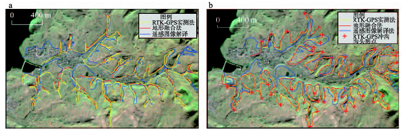
| 图5 检验区冲沟参数解译结果比较(a:沟底线, b:沟沿线) |
| Fig. 5 Comparison of the gully parameters in the validation area (a: gully thalweg, b: gully edge line) |
|
|