基于Google Earth和MODIS陆地数据的农林地转换对地表温度的影响——以长江中下游及毗邻地区为例
|
|
赵彩杉, 曾刚, 张丽娟, 张学珍
|
Effects of cropland and woodland conversion on land surface temperature based on Google Earth and MODIS land data: A case study of the middle and lower reaches of the Yangtze River Basin and its adjacent areas
|
|
Caishan ZHAO, Gang ZENG, Lijuan ZHANG, Xuezhen ZHANG
|
|
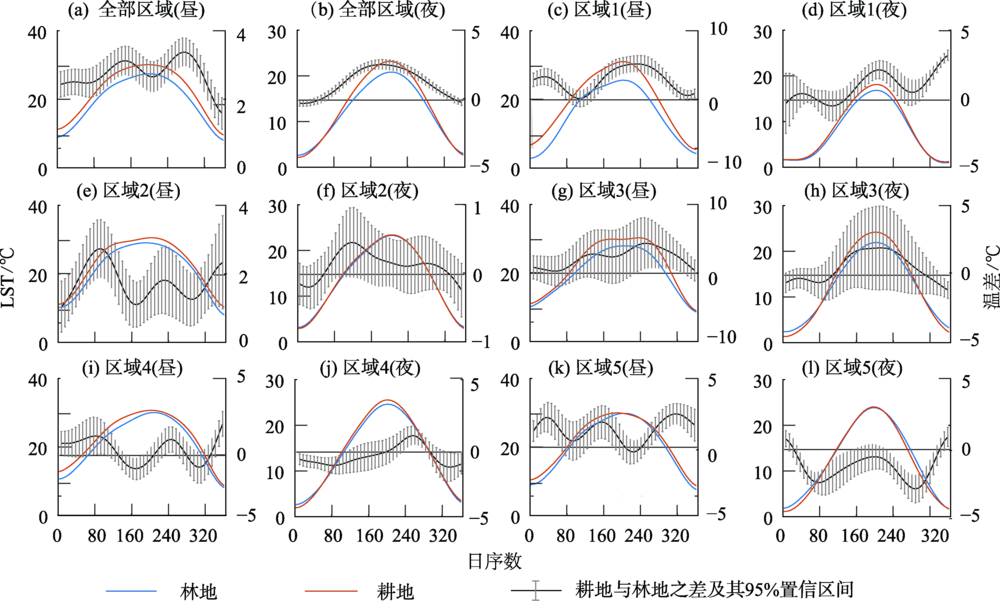
| 图2 各区域耕地与林地地表温度(左侧纵轴)及其差异(右侧纵轴)的季节动态 |
| Fig.2 Seasonal cycles of land surface temperature (refers to left vertical axis) of cropland and woodland and the differences (refers to right vertical axis) between these two land cover types |
|
|
|
|