基于Google Earth和MODIS陆地数据的农林地转换对地表温度的影响——以长江中下游及毗邻地区为例
Effects of cropland and woodland conversion on land surface temperature based on Google Earth and MODIS land data: A case study of the middle and lower reaches of the Yangtze River Basin and its adjacent areas
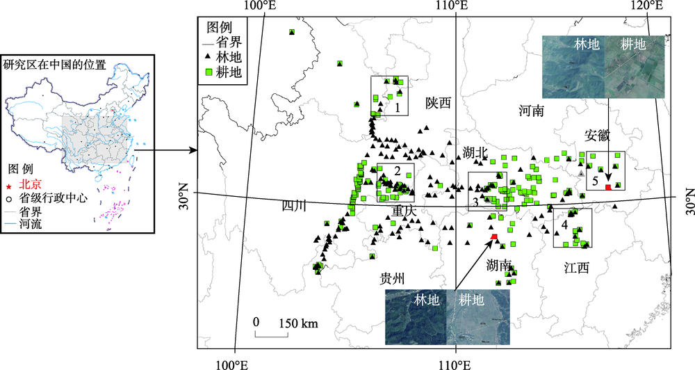
注:本图中中国全图基于国家测绘地理信息局标准地图服务网站下载的审图号为GS(2016)2893号的标准地图制作,底图无修改。1、2、3、4、5为所选区域编号,依次为陕甘交界处、川渝地区、湖北中南部、江西北部和安徽中南部。